Uptown Walking Trails
Listed on this page are eight walking trails located in the Uptown area near the Government Center. On the maps below, the Government Center Tower is represented by the blue pin.
Total trail distances are calculated based on completing one round trip (beginning from start point, walking the trail, then returning to the start point).
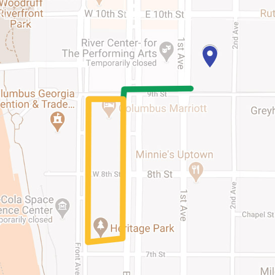
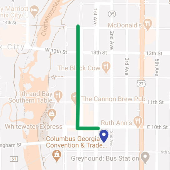
Heritage Park
Total trail distance: 0.838 miles
Leg #1: 669 feet
Starting at the corner of 9th Street and 1st Avenue, walk west to the corner of 9th Street and Broadway. Turn left and walk along Broadway (the Columbus Marriott should be immediately on your right).
Leg #2: 0.585 miles
Continue until you reach the entrance to Heritage Park, on your right (just before the intersection of Broadway and 7th Street). Walk through Heritage Park. After exiting Heritage Park, turn right and walk along Front Avenue. Continue on Front Avenue until you reach the intersection of Front Avenue and 9th Street. Turn right and walk to the corner of 9th Street and Broadway.
From the corner of 9th Street and Broadway, do another lap through Heritage Park or return to the Government Center.
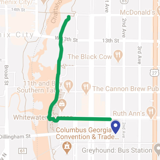
Riverwalk
Total trail distance: 1.754 miles
Starting at the corner of 10th Street and 1st Avenue, walk west to the Riverwalk. To access the Riverwalk, you will be required to walk down steps. After reaching the Riverwalk, turn right and continue walking along the Riverwalk until you reach the 14th Street Pedestrian Bridge. At the bridge, turn around and walk back to the spot where you entered the Riverwalk. Climb the steps and return to the Government Center.
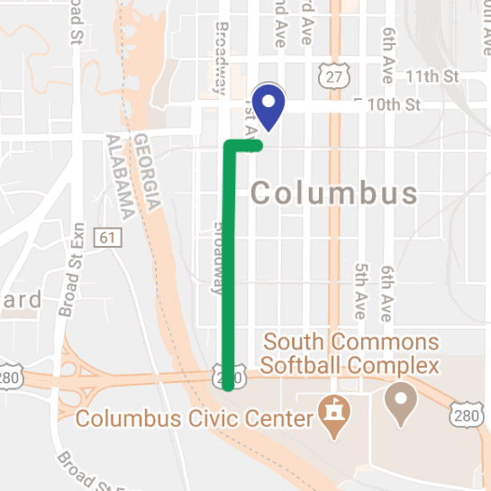
Golden Park
Total trail distance: 1.59 miles
Starting at the corner of 9th Street and 1st Avenue, walk west to the corner of 9th Street and Broadway. Turn left and walk along Broadway until you reach Golden Park (about five blocks). When you reach Golden Park, turn around and retrace your path to the Government Center.
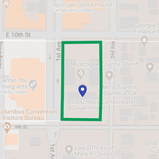
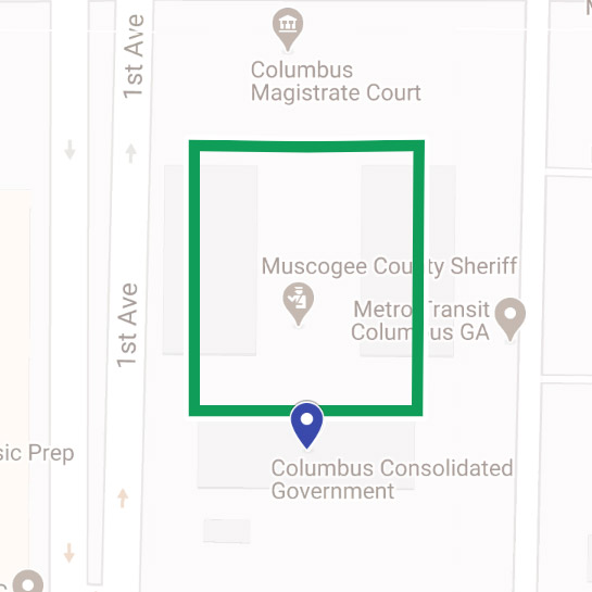
Lap Around Government Center
Total trail distance: 0.345 miles
Starting at a corner of your choosing, walk around the Government Center.
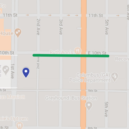
Public Safety Complex
Total trail distance: 0.522 miles
Starting at the corner of 10th Street and 2nd Avenue, walk east to the corner of 10th Street and 5th Avenue. Turn around and return to the Government Center.
Lap Around Parking Level 1 / Level 2
Total trail distance: 0.196 miles
Walk around parking level 1 (P1) or parking level 2 (P2).
Government Center's Stairwell
Total trail distance: Unknown
Starting from the basement of the Government Center, climb the stairs to the 11th floor of the Government Center. Take the stairs back down to the basement. Good luck!
TSYS Campus
Total trail distance: 1.31 miles
Starting from the corner of 10th Street and 1st Avenue, walk west to the corner of 10th Street and Broadway. Turn right and walk along Broadway to 14th Street. Turn around and return to the Government Center.
* Distances are estimated using Google Maps measurement feature.